
How to Search
![]()
Search by facility / equipment
Search by facility type or the type of accessibility equipment.
How to Search
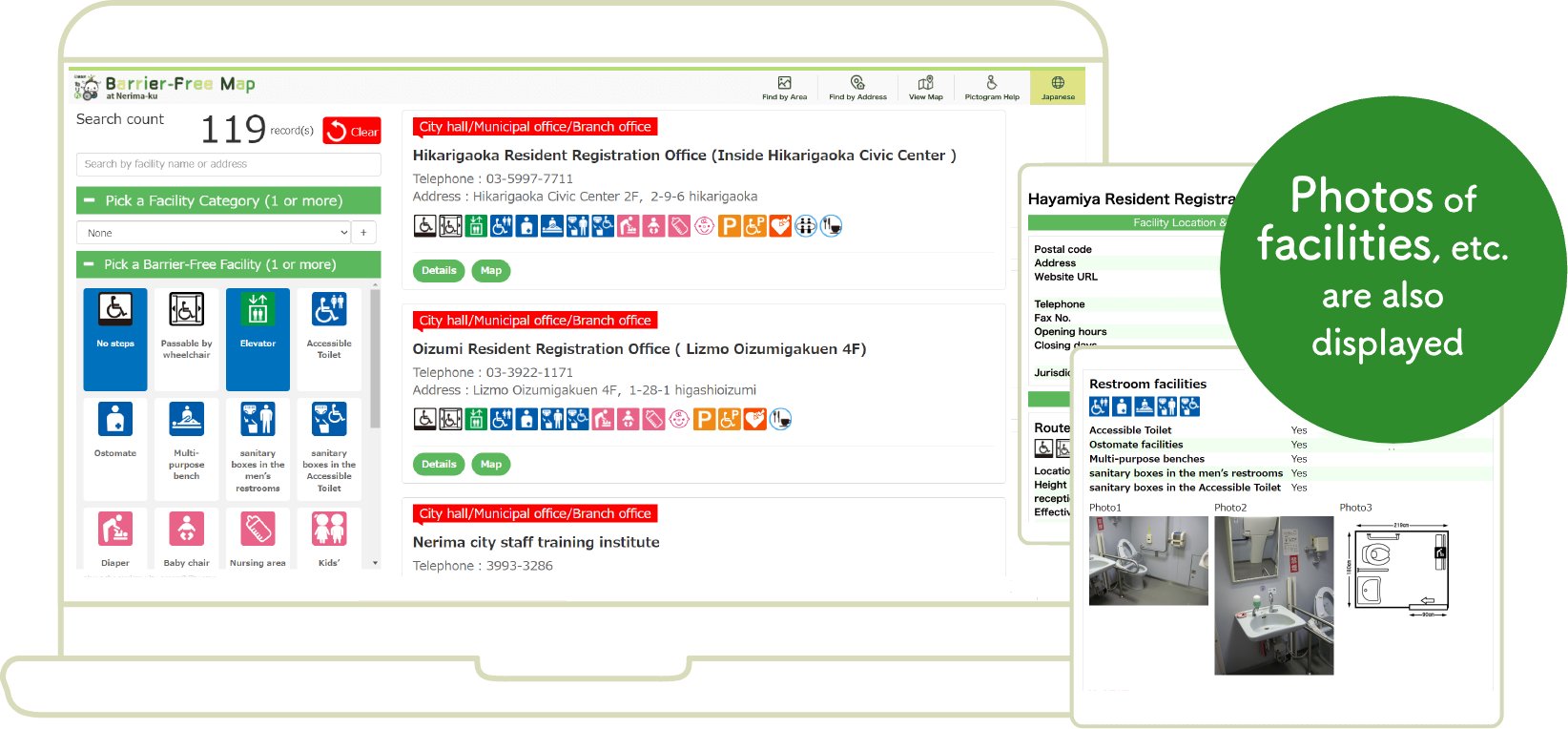
- Enter search terms (facility name, address, etc.)
- Select the facility type (multiple choices allowed)
- Select the type of accessibility equipment (multiple choices allowed)
Displays search results
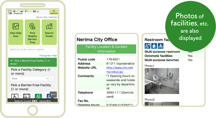
![]()
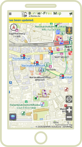
Search from Map
Search for accessible facilities using the map.
You can search for travel routes and information on accessibility in the area around your route.
Main features
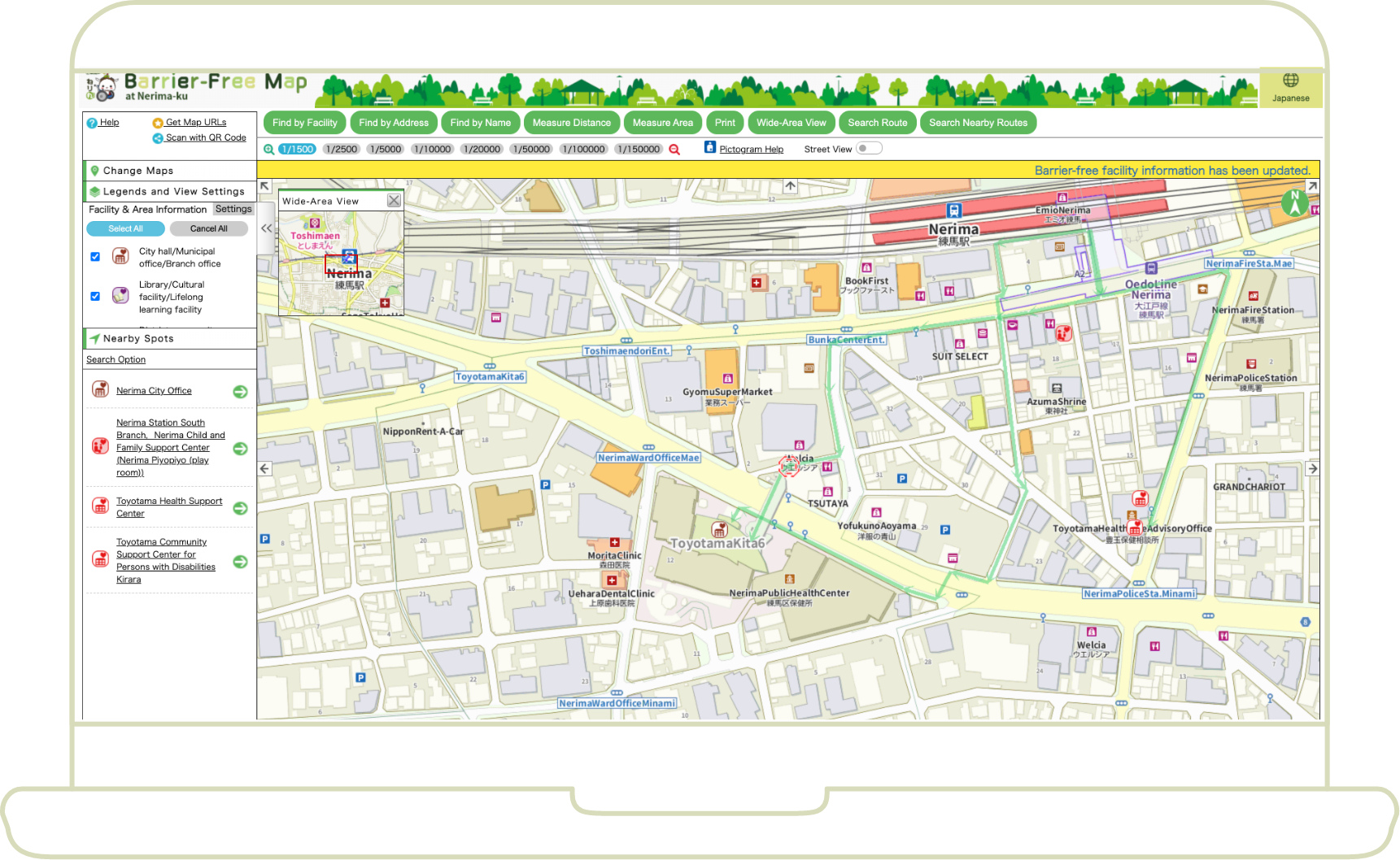
- Route & route area facility search function
- Distance & area measurement
- Picture drawing function
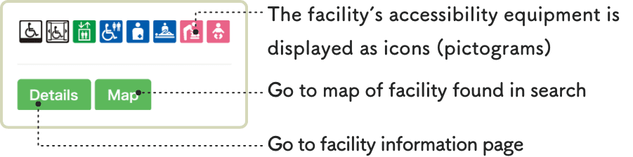
Icon List
Equipment icon list
Displays accessibility equipment as easy-to-understand icons (pictograms).
Select an icon to check facility information.
Route from road to main reception area
-

- No Steps
-

- Passable by wheelchair
Elevator
-

- Elevator
Restroom facilities
-

- Ostomate *1
-

- Multi-purpose bench
-

- Accessible Toilet
-

- sanitary boxes in the men’s restrooms
-

- sanitary boxes in the Accessible Toilet
Infant facilities
-

- Baby spot
-

- Diaper changing station
-

- Kids’ restroom
-

- Nursing area
-

- Baby chair
Parking
-

- General parking
-

- Parking for wheelchair users
Other facilities
-

- Hearing Loop*2
-

- AED
-

- On-site cafe / restaurant available
-

- Rental conference room available
- An ostomate is a person with an artificial anus or bladder in the abdomen for excretion of waste.
- Hearing Loop is equipment that provides hearing assistance for persons with auditory impairment. By using a hearing aid equipped with a magnetic coil, users are able to hear only the desired sounds/voices as audio signals.
Facility, etc. icon list
Facility types are displayed as icons to allow for easy searching.
This lets you check facility information by looking at the displayed icons.
-

- City hall/Municipal office/Branch office
-

- Library/Cultural facility/Lifelong learning facility
-

- District community center/Regional meeting place
-

- Sports facility
-

- Childcare support facility
-

- Hatsuratsu Center /Keirokan
-

- Other health/welfare facility
-

- Other municipal facility
-

- Park/Greenspace
-

- Public parking
-

- Public office, etc.
-

- Hospital/Medical facility
-

- Commercial facility
-

- Educational institution
-

- Elevator
-

- Travel route
-

- Audio traffic signal
-

- Incline
-

- Train station
-

- Incline